Project Name: Living through the extremes : Enhancing livelihood resilience
Student Name: Anushka Ashok Gawad
Awards: Shortlisted Top 30 - Architecture Thesis of the Year 2022 by Charette | TOP 10 SELECT MENTIONS - Architectural Thesis Award 2022 by Mango Architecture | Honorable Mention in Archresource Thesis Awards
Excerpt:‘Living through the extremes : Enhancing livelihood resilience’ is an architecture thesis based on community development by Anushka Ashok Gawad from the Kamla Raheja Vidyanidhi Institute of Architecture and Environmental Studies (KRVIA) that seeks to provide architectural solutions for the Arnala Island coastal community to adapt and grow into systems that are resistant to calamities. By incorporating changes into the existing networks, the intervention creates collective infrastructure bodies for occupations, celebrations, and community gatherings.
Introduction: The livelihood of coastal communities is being negatively impacted by coastal hazards that have arisen as a result of global climate change. It is clear that most coastal livelihoods are vulnerable to regularly occurring threats like monsoon flooding, even in the absence of a major disaster like a large tsunami. This raises the question of how the coastal community living on Arnala Island, India, can begin to adapt and develop into systems that are resilient to disasters.
The Arnala community has a long history of living on the outskirts of the island and engaging in particular types of employment. Coastal hazards pose a threat that will result in the relocation of livelihood infrastructure, upending years of established systems within the Koli community. Life on the island will be in danger due to the threat to their means of subsistence.
It will take an extensive reconstruction to improve the infrastructure that the islanders depend on to maintain their way of life. The goal of the project is to design a model for how the Arnala Island coastal community can start to adapt and grow into systems that are resistant to calamities. The thesis focuses on incorporating changes into the existing networks and creating collective infrastructure bodies for occupations, celebrations, and community gatherings.
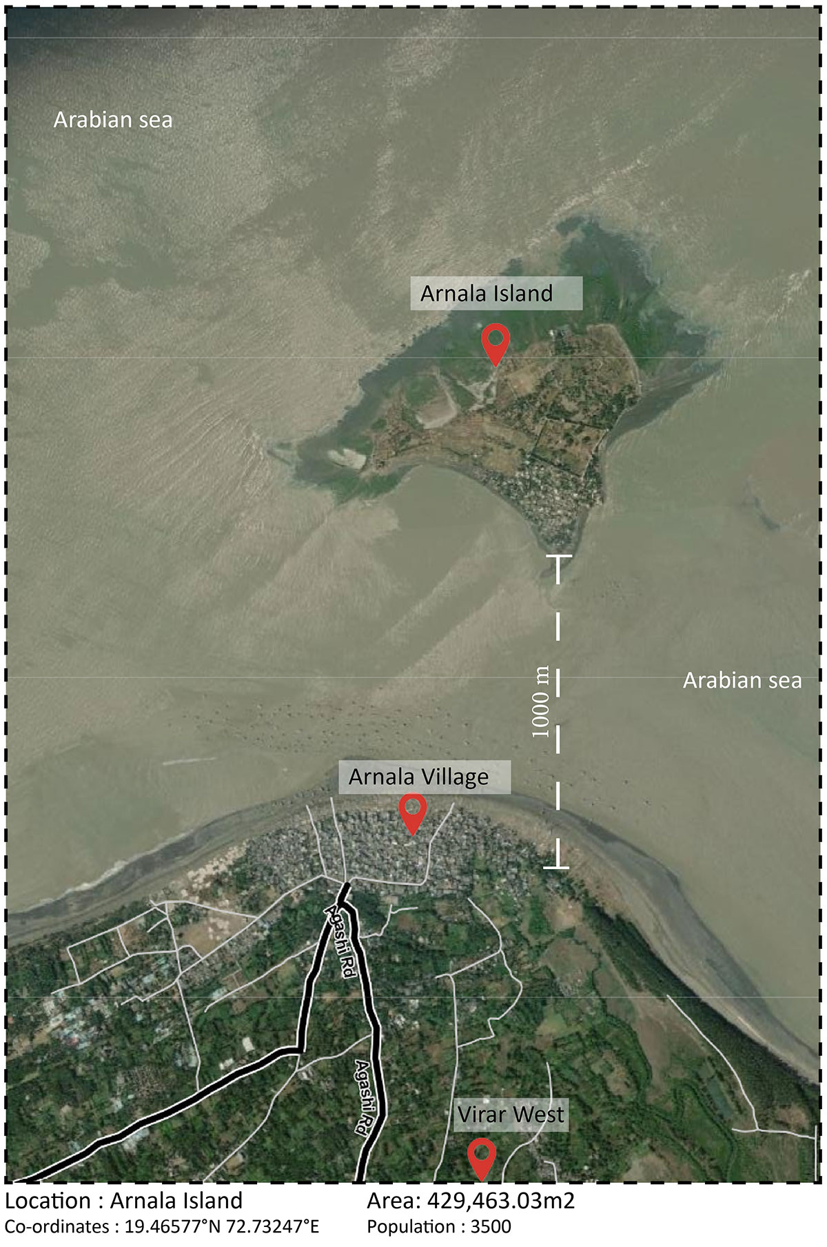
Site Location (Source: Google Earth) and Vulnerability of the Village to Coastal Storms
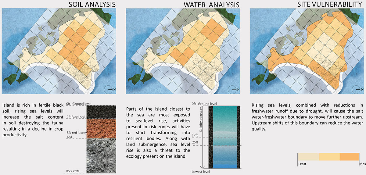
Inventory and Analysis of the Island
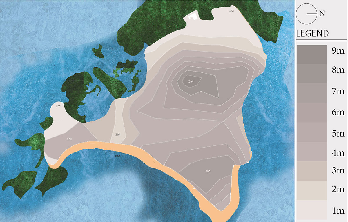
The Arnala island is located off the coast of Mumbai, in the Indian state of Maharashtra. The island’s topographical study reveals high-ground areas in the northeastern and northern regions. Low-lying regions of the island are defined by the land’s slope towards the island’s western and southern borders.
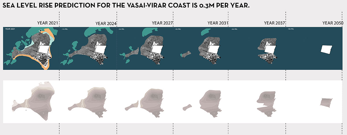
Sea Level Rise Prediction for Different YearsSite SectionsSite Vulnerability Analysis
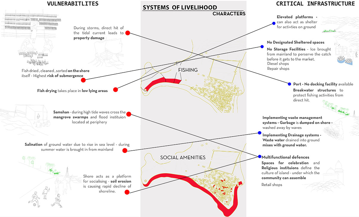
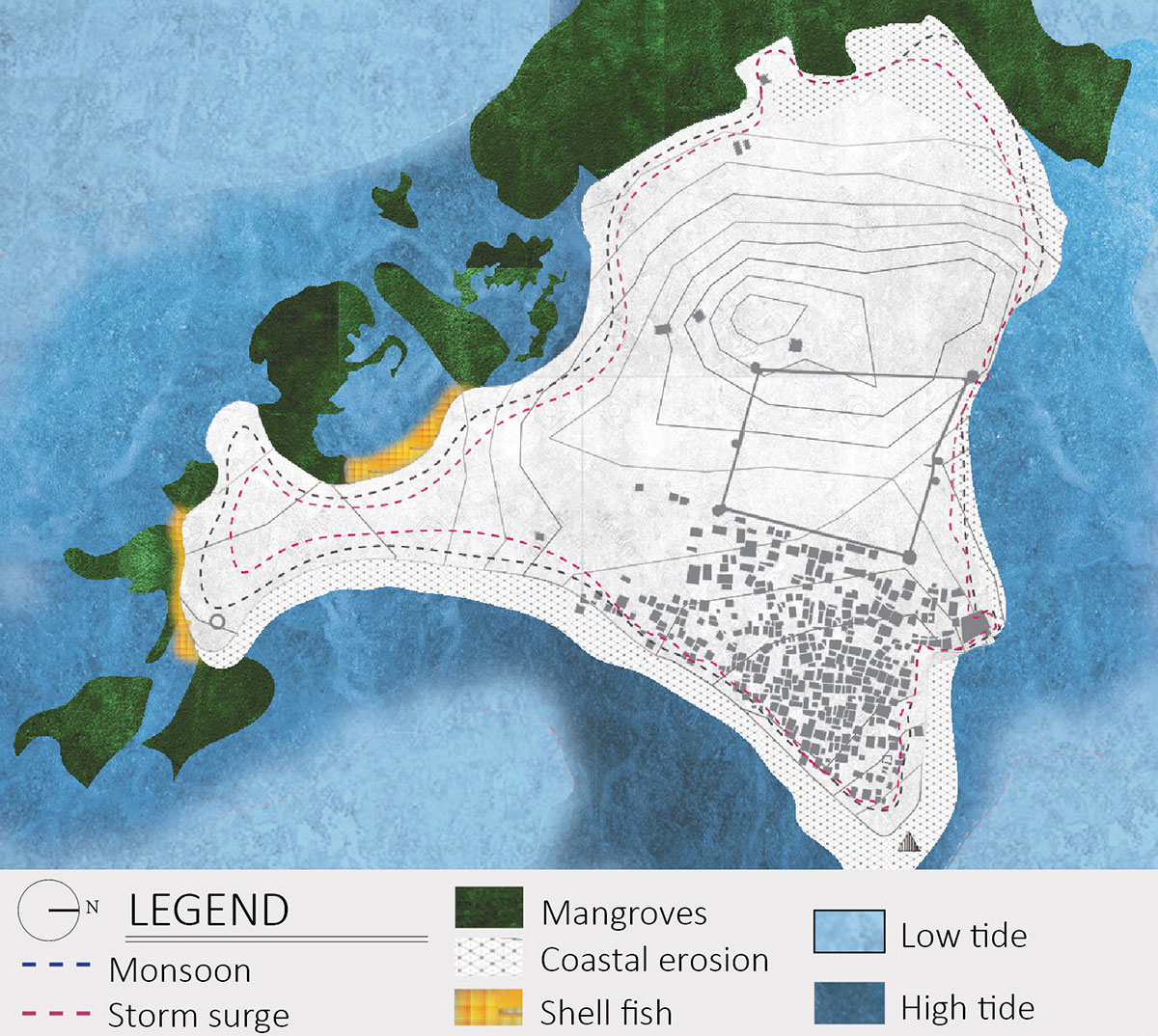
Rising sea levels result in coastal flooding, which exacerbates soil erosion. The shoreline that stretches along the island’s eastern and northern borders is rapidly receding as a result of soil erosion. Due to sand displacement, the village is now close to the ocean, putting homes built along the edge at risk of flooding during storms. Low-lying areas are kept from flooding by the mangrove swamps that encircle the island’s western and southern edges. A crucial region for the fishing industry is the southeast border; during storms, the waves directly strike this border, causing property damage.
Site Narratives
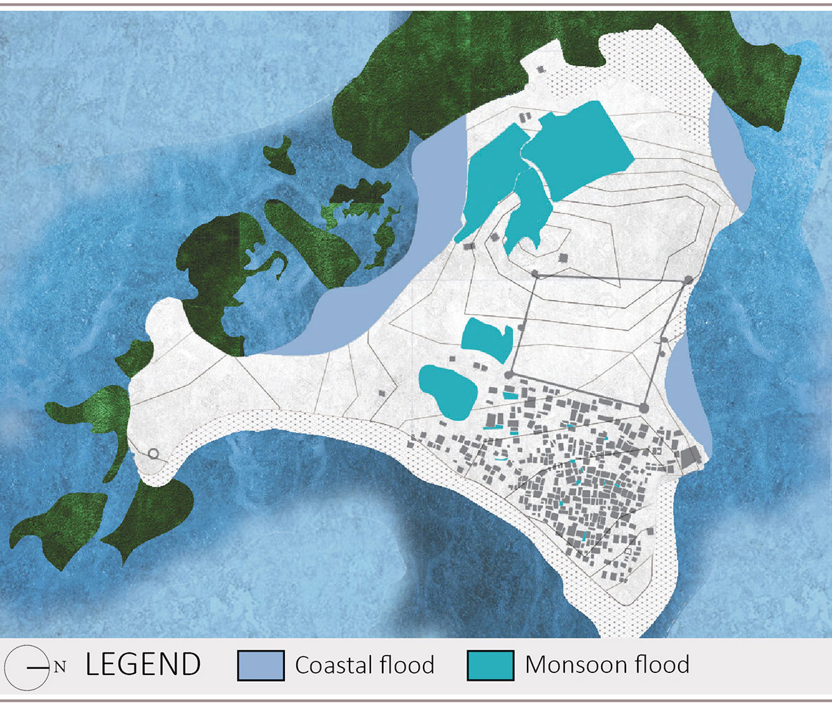
Floodplains indicate the weak spots on the island where stormwater can enter the area. Flood plains are created by the low-lying topography of the island on the southern side, while those on the north-western edge are the result of years of sand mining-related sand displacement. At this edge, the mangrove swamps are not well developed. The interior monsoon flood plains are man-made areas used for agriculture. The village’s water supply is clogged as a result of urbanisation.
Primary Spaces of AidPrimary Spaces of Aid
Spaces of livelihood
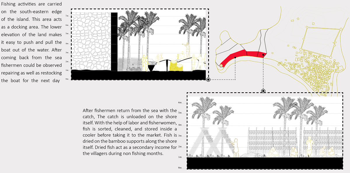
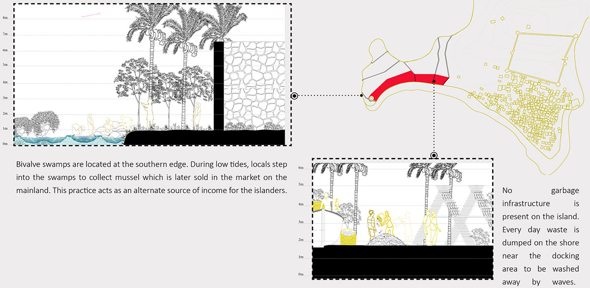
Primary spaces of aid: On the southeast coast of the island, fishermen fish while maintaining and restocking their boats. On the shore, the catch is unloaded, sorted, cleaned, and stored. The villages gain extra income from dried fish. During low tide, mussels are harvested from bivalve swamps on the southern border and sold on the mainland. The waste is deposited on the shore and carried away by the waves since the island lacks a garbage infrastructure.
Secondary Spaces of Aid
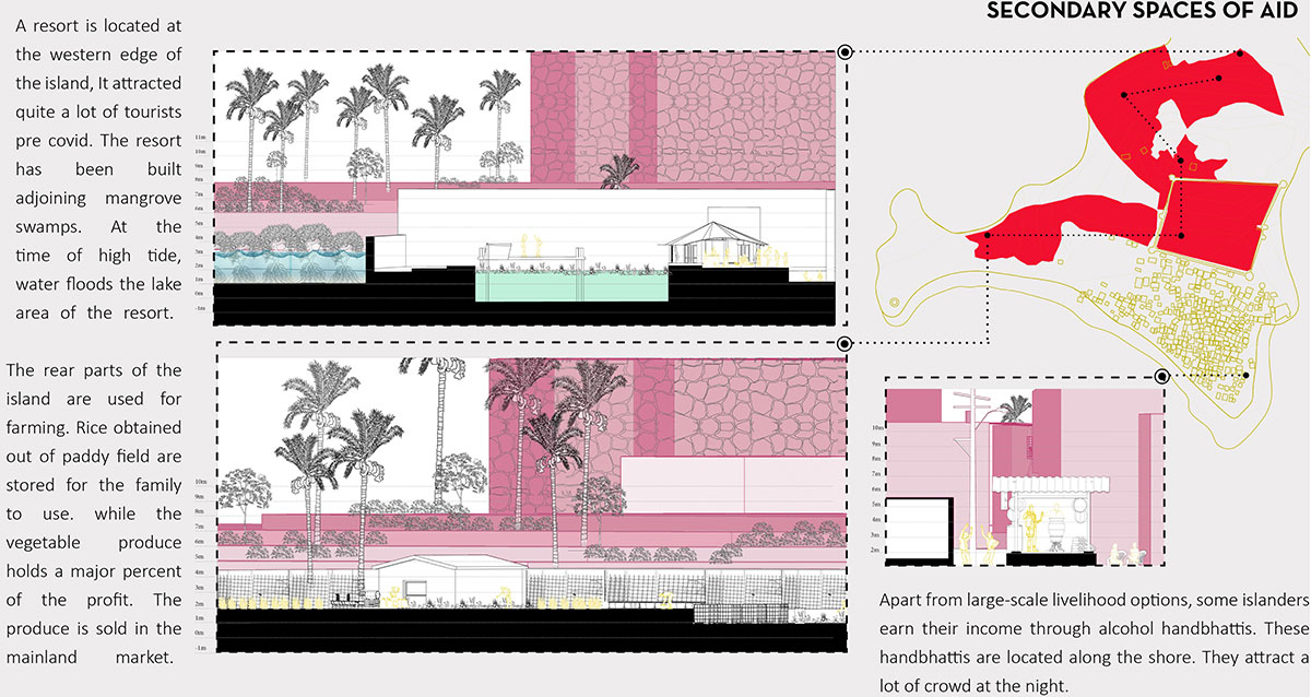
Secondary spaces of aid: Before COVID-19, tourists frequented a resort located on the western side of the island. It was constructed next to mangrove swamps, which flood at high tide. Farming is done on the back side of the island; vegetables are sold in mainland markets and rice is stored for domestic use. Some islanders earn income through alcohol handbhattis along the shore, which attract crowds at night.
Design Process
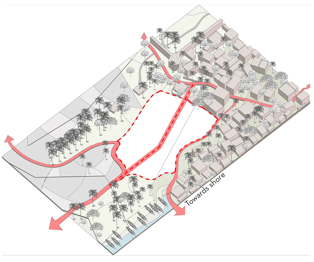
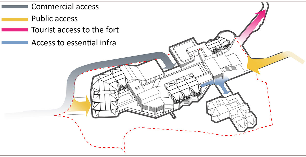
Identifying Access RoutesAccess to the Building
Site strategies
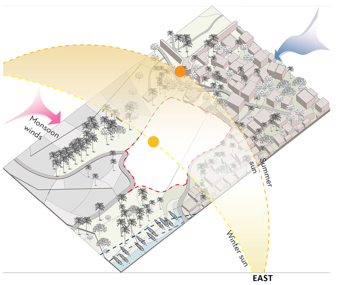
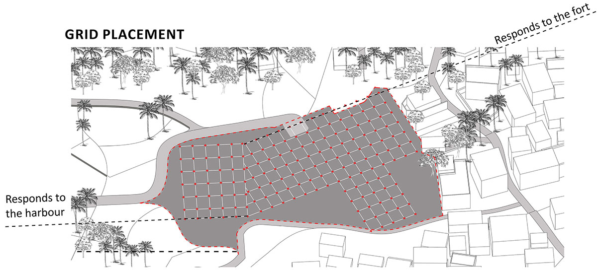
Access Routes: New networks were formed on the site while taking into account the existing movement routes. In order to continue current activities on the site without needing to be relocated, the building is positioned between two existing pedestrian routes.
Prevailing winds: In order to benefit from the prevailing winds and provide cross ventilation, the building is oriented towards the north and northeast.
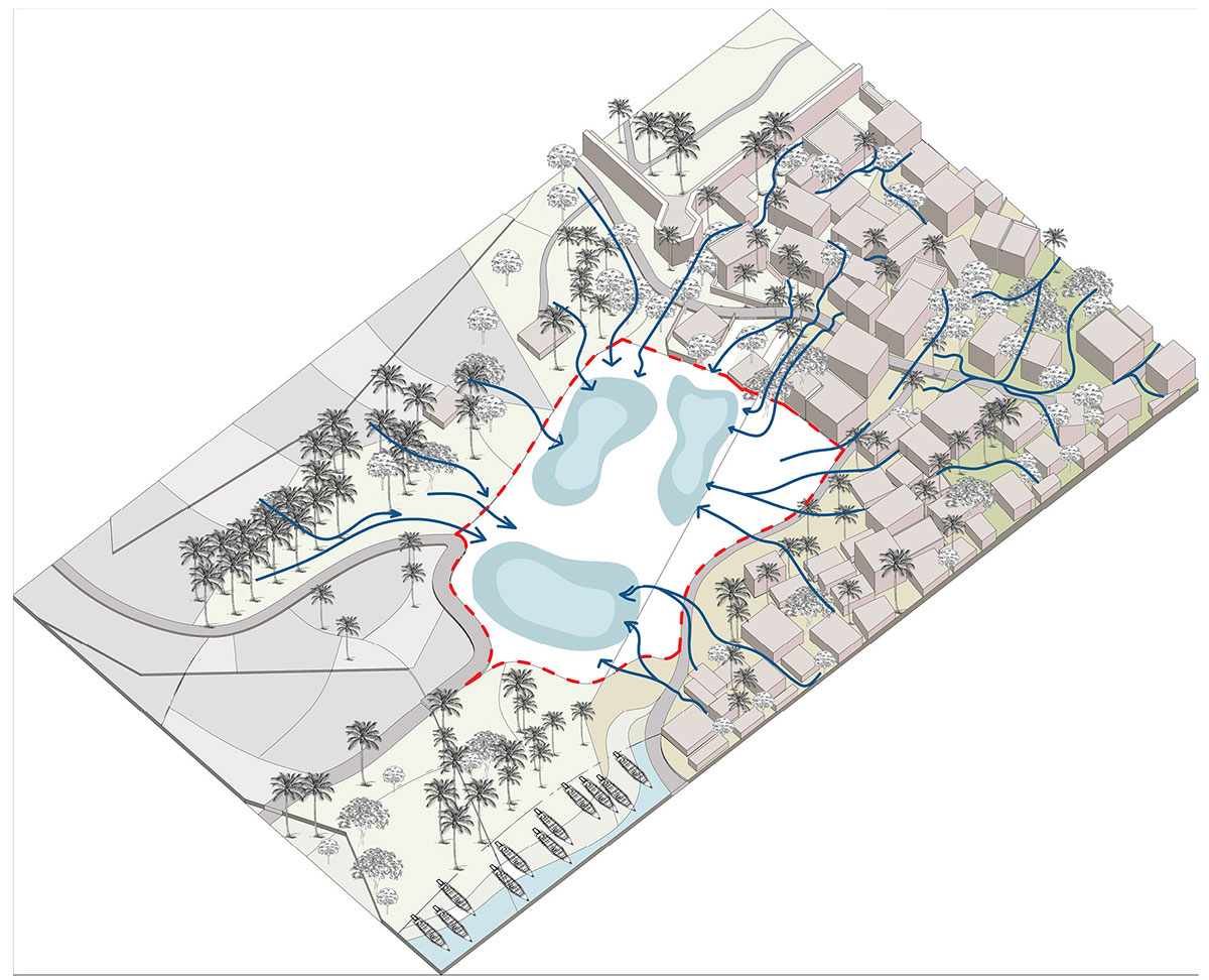
Identifying Catchment AreasGround Treatment
Catchment area: Being able to facilitate the water collection process was one of the requirements in selecting a site to build. Because of its topographical features, the site selected functions as a natural catchment area. During the monsoon, water flow is directed into the site by the surrounding contours that slope downhill.
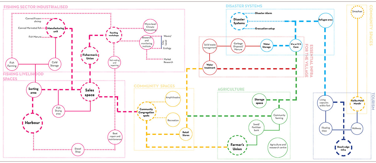
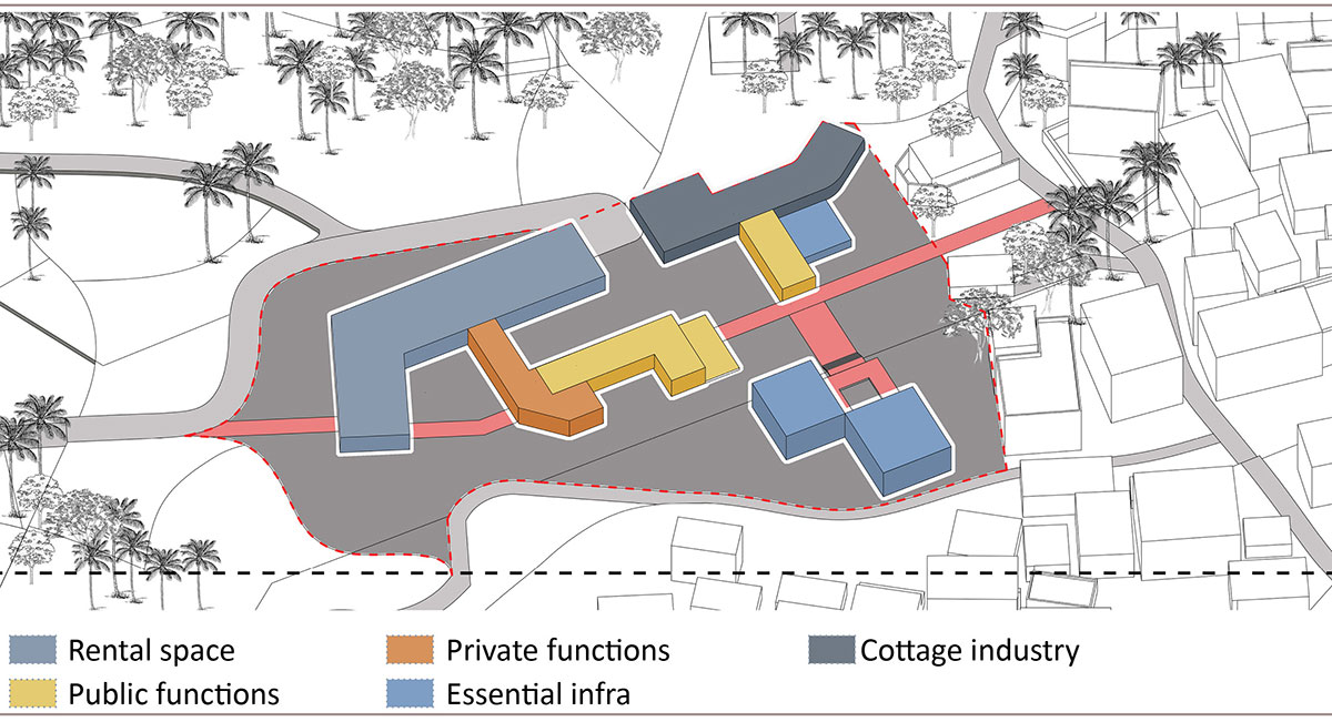
Programmatic Arrangement on SiteProgram Placement
The functions have been divided into various categories, which include rental space, cottage industry, essential infrastructure, and private and public functions. These spaces include fishing sector industry, livelihood spaces, community spaces, agriculture and disaster systems, and tourism spaces.
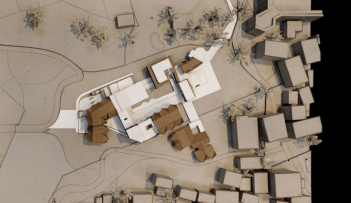
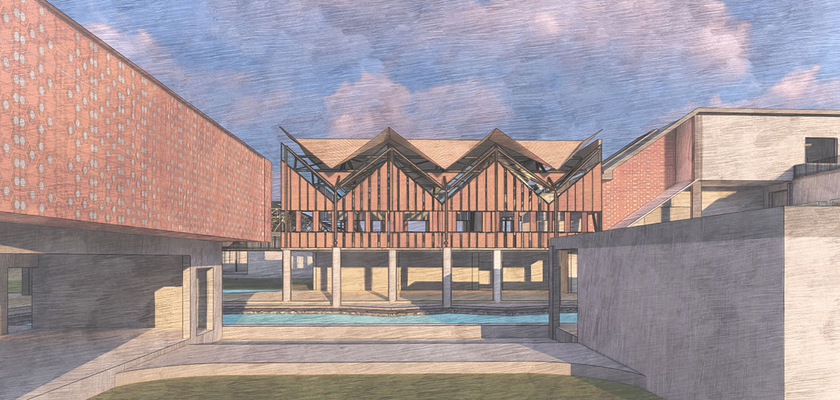
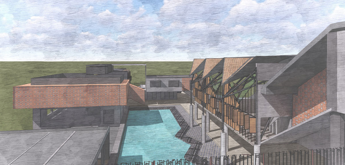
Final Outcome
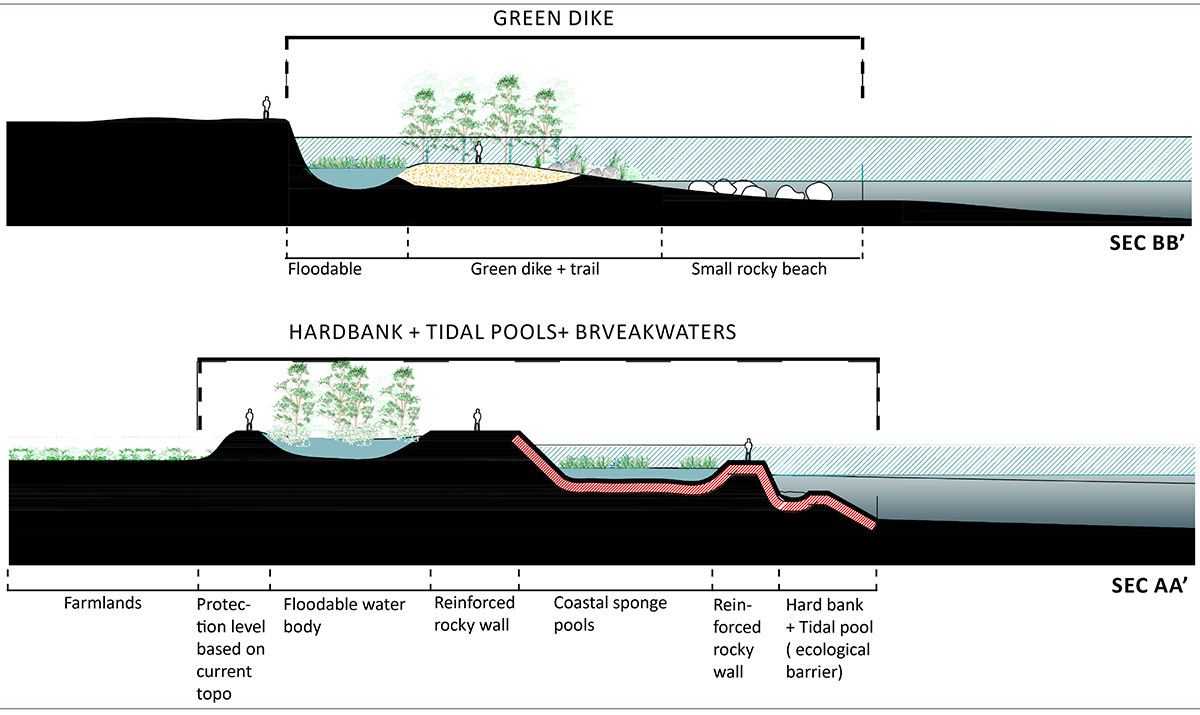
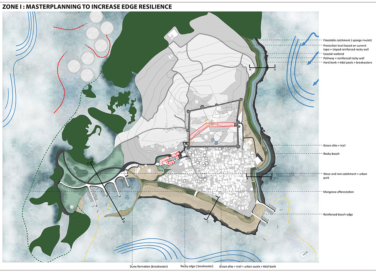
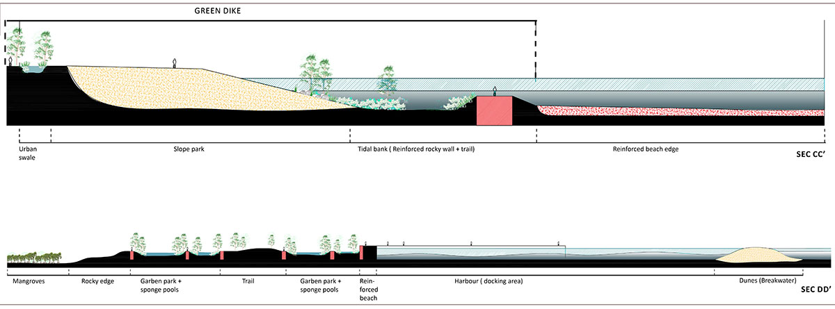
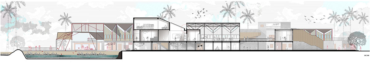
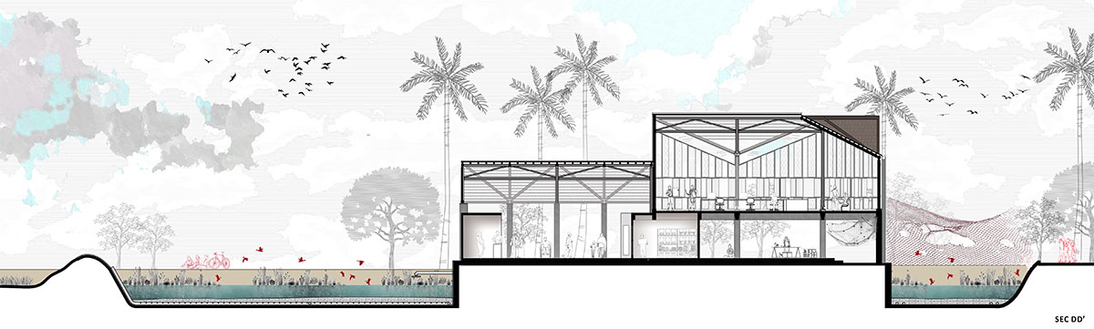
Masterplanning to Increase Edge ResilienceSite Sections
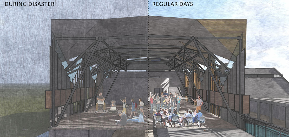
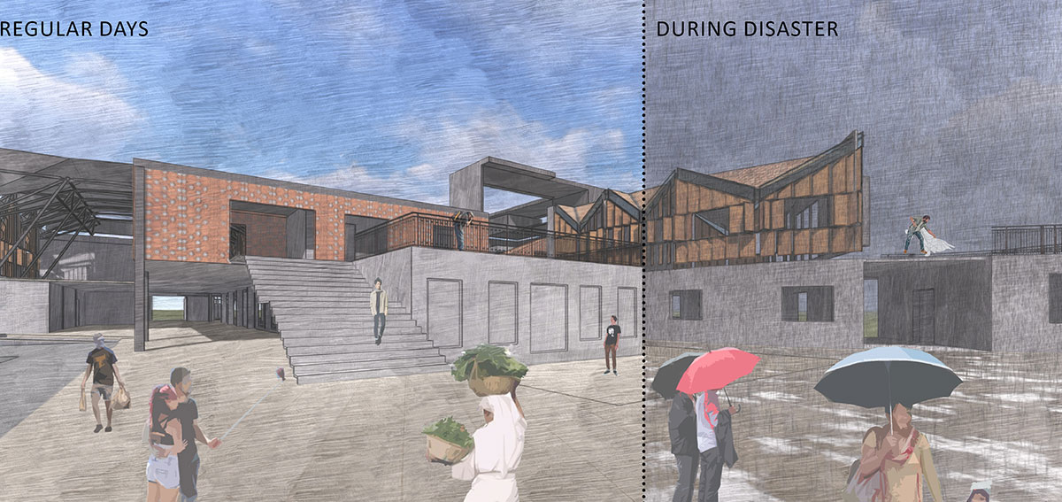
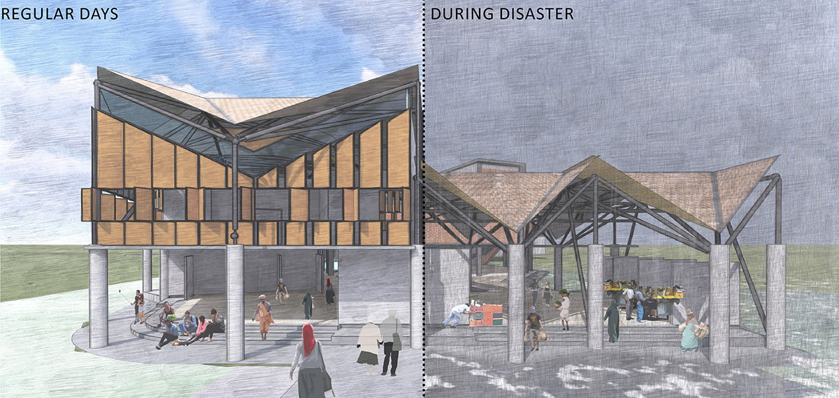
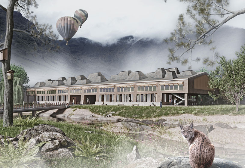
The architecture is intended to serve as a multifunctional area for community gatherings, celebrations, and livelihood activities. Disaster relief systems should be placed in locations where islanders can easily access them during a crisis. The architecture designed for Arnala’s population to share will house collective infrastructure systems.
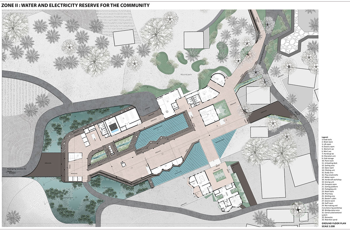
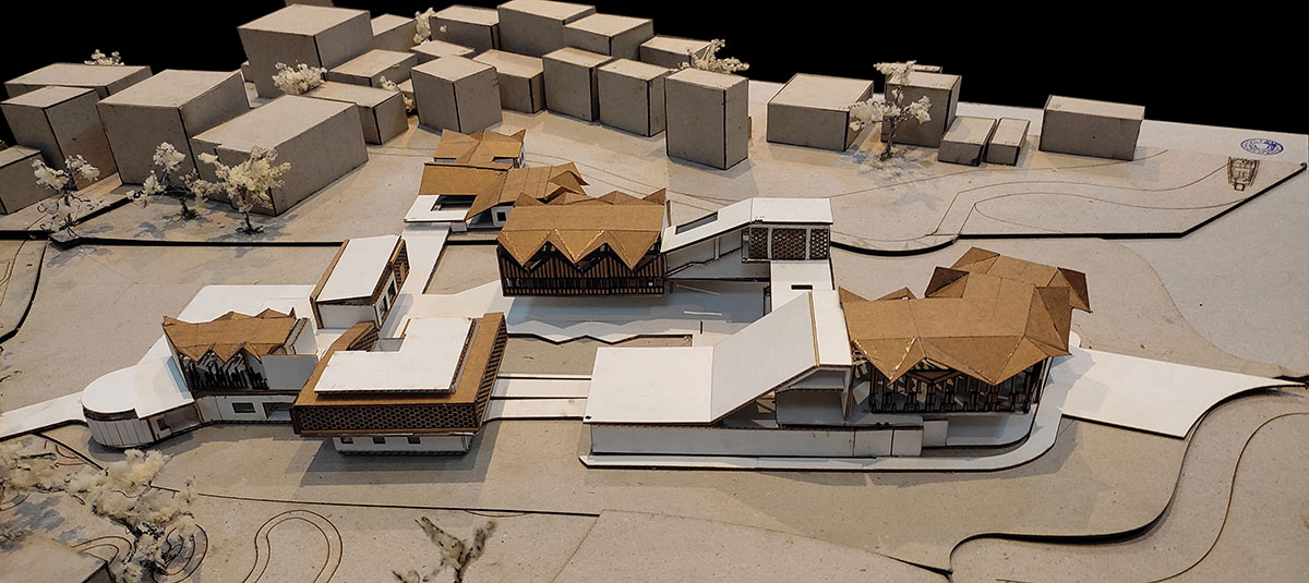
Ground Floor Plan of the Water and Electricity ReserveSectionPhysical Model
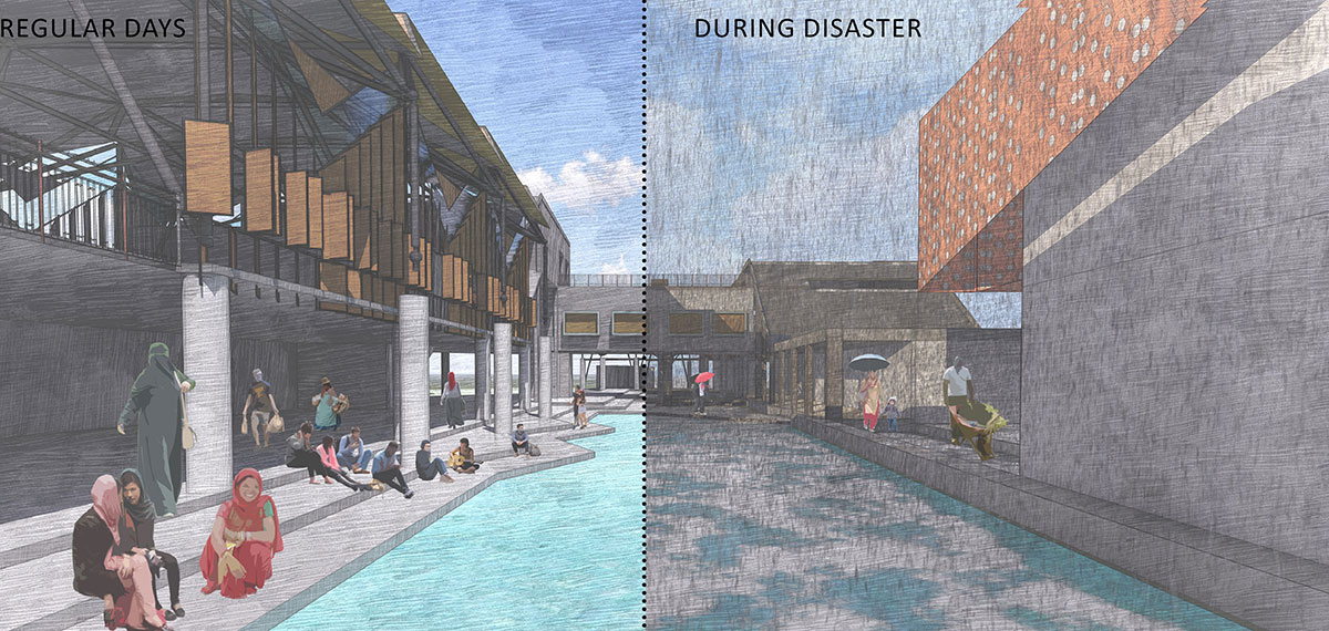
These collective bodies function as resilient systems in times of calamity. They will help lessen the effects of coastal storms and sea level rise. They serve as a means of supporting the livelihood and way of life of the islanders on regular days.
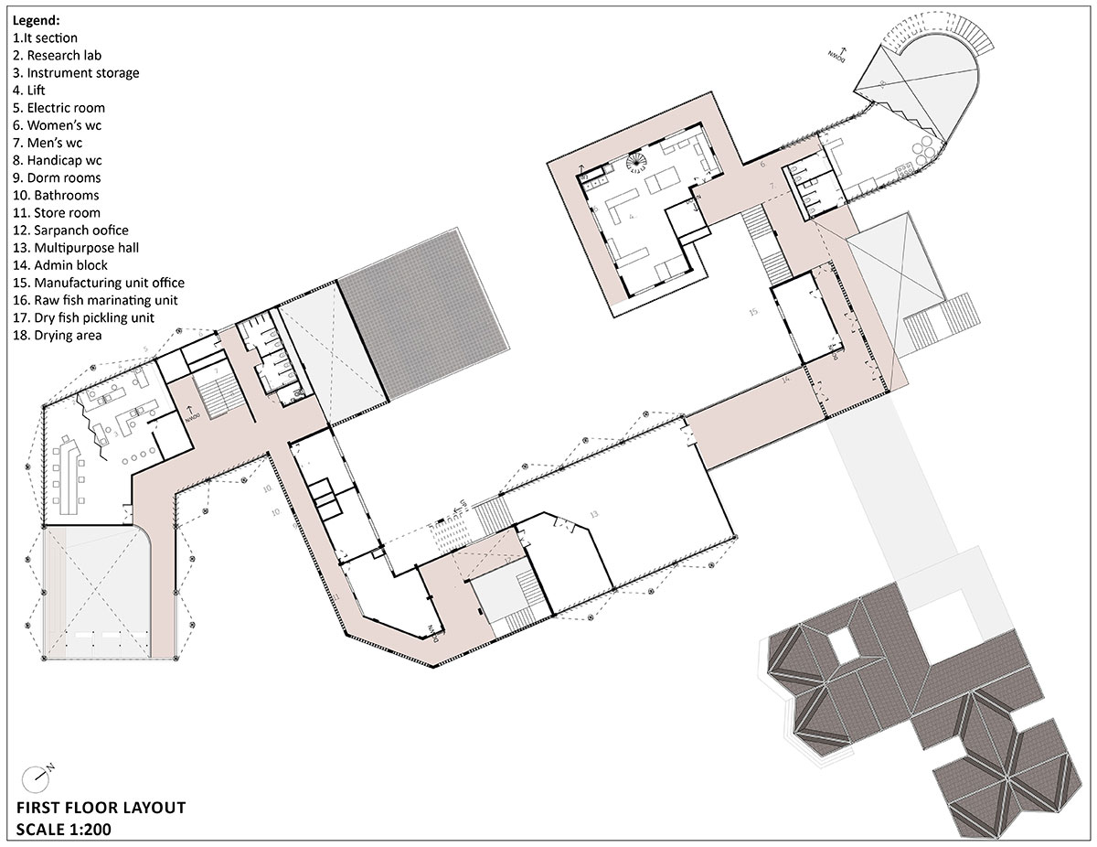
First Floor Plan of the Water and Electricity ReserveMultipurpose Spaces for Formal and Informal Activities
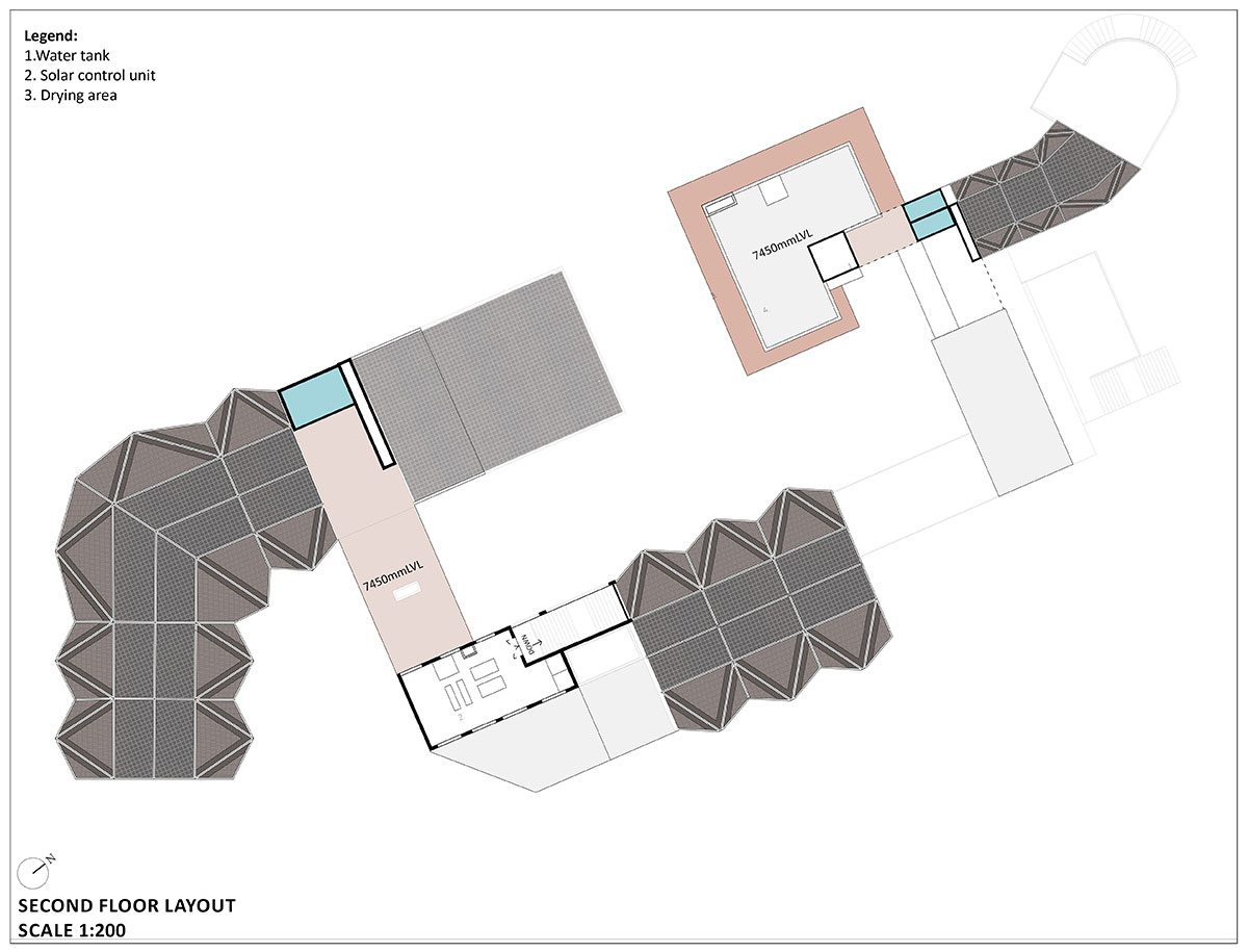
More public programmes are located on the ground floor, which attracts more people to the workshop and sales areas and helps the islanders make money. Intimate and private programmes, like labs and a multipurpose hall that can be rented out to potential users, are located on the first floor.
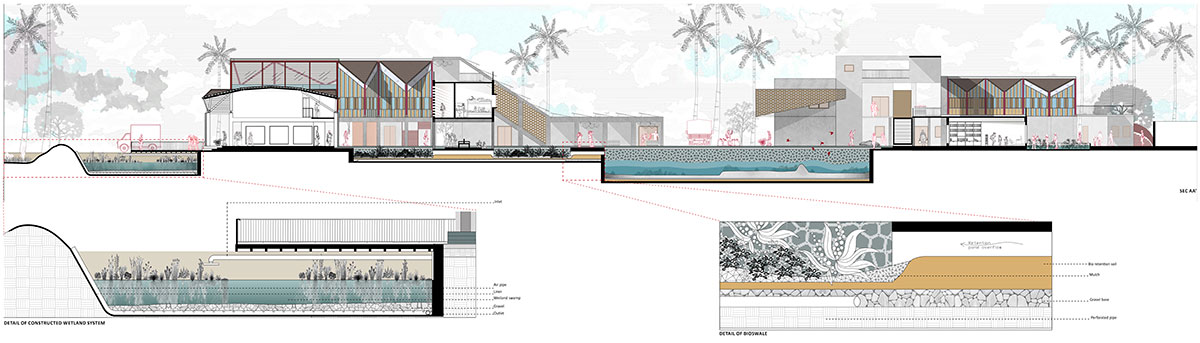
SectionPotential of the Water Bodies Constructed on the Site
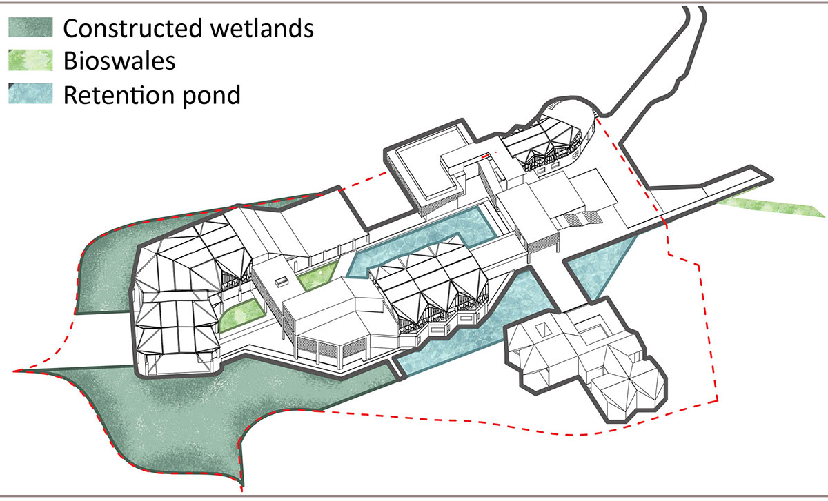
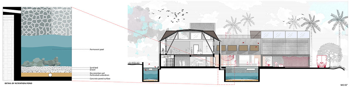
It is envisioned that the women of the village will run the manufacturing facility; the initiative will create employment opportunities for the fishermen’s wives. The ground has been sculpted to accommodate filter systems, bioswales, and retention ponds. In the event of a disaster, this system will collect, filter, and store water.
Second Floor Plan of the Water and Electricity ReserveSection
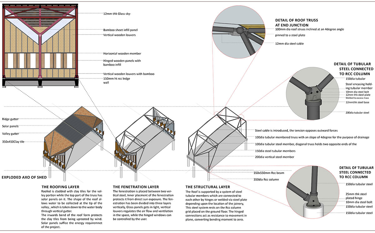
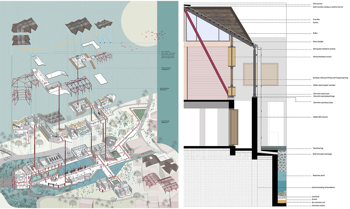
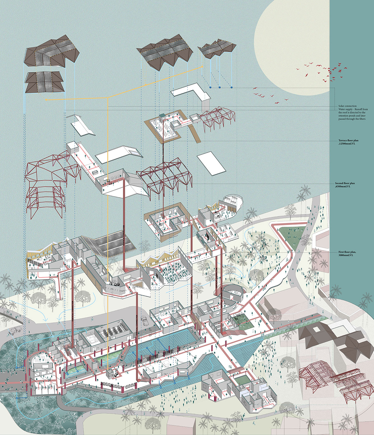
Structure of the architecture
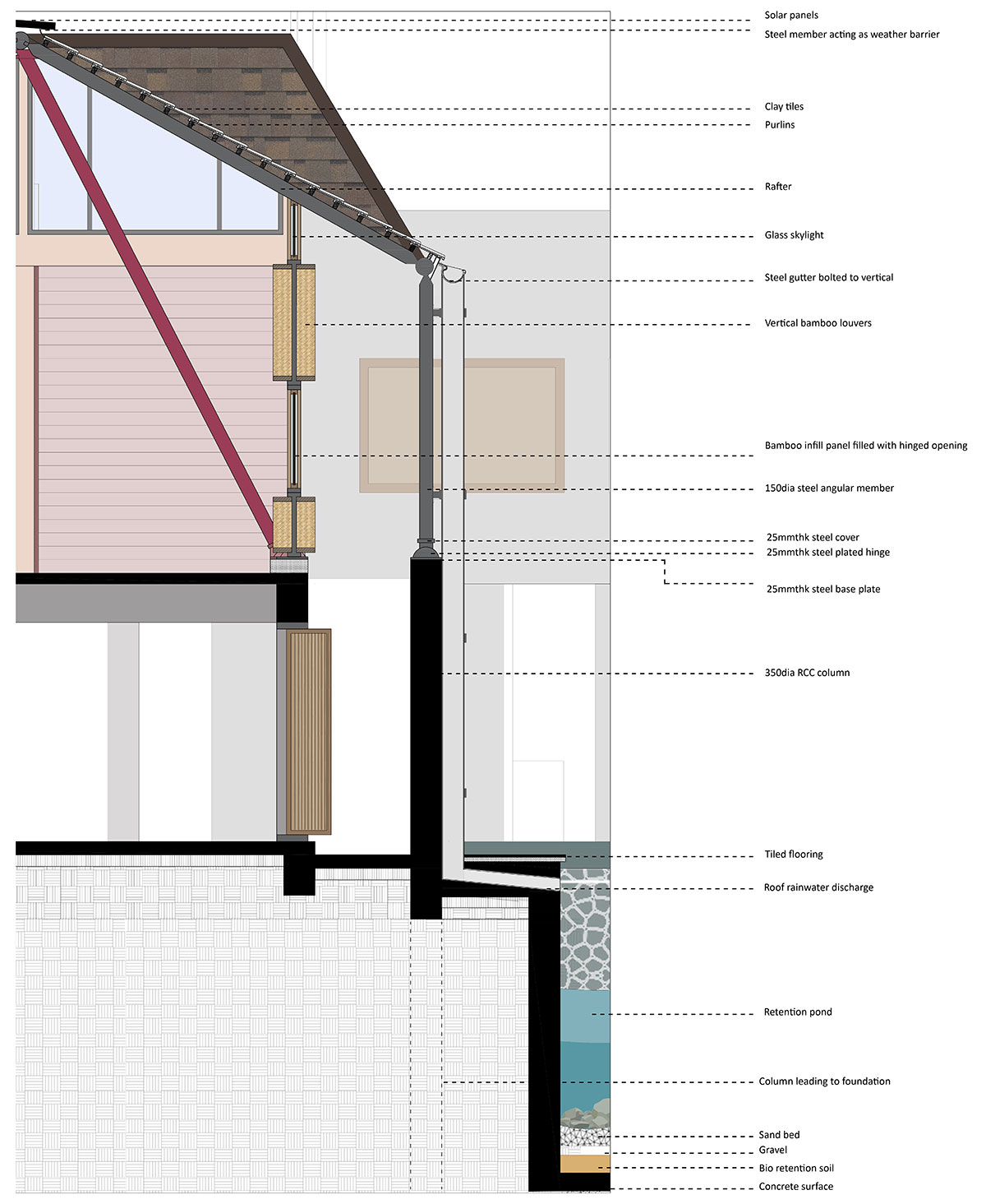
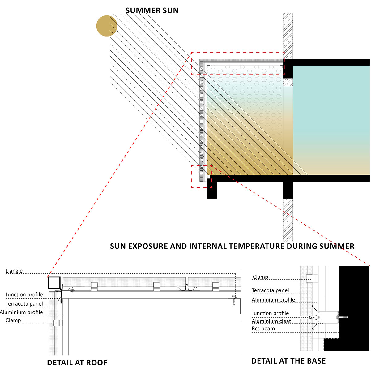
The Roofing Layer: The top of the truss is covered in solar panels, while the valley portion of the roof is covered in clay tiles. Given the roof’s shape, water can collect at the valley’s tip and be carried by a vertical gutter down to the water body. The roof form’s inward bend prevents wind from uprooting the clay tiles. The project’s energy requirements are supplied by the solar panels.
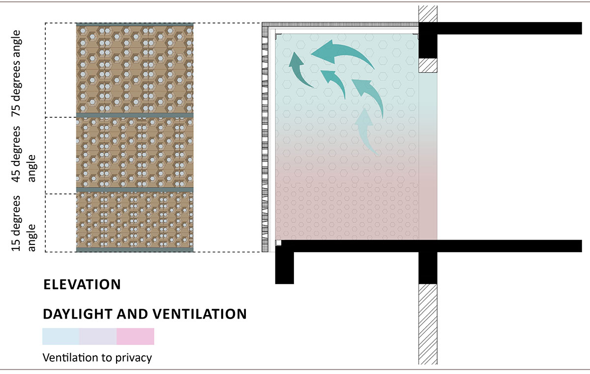
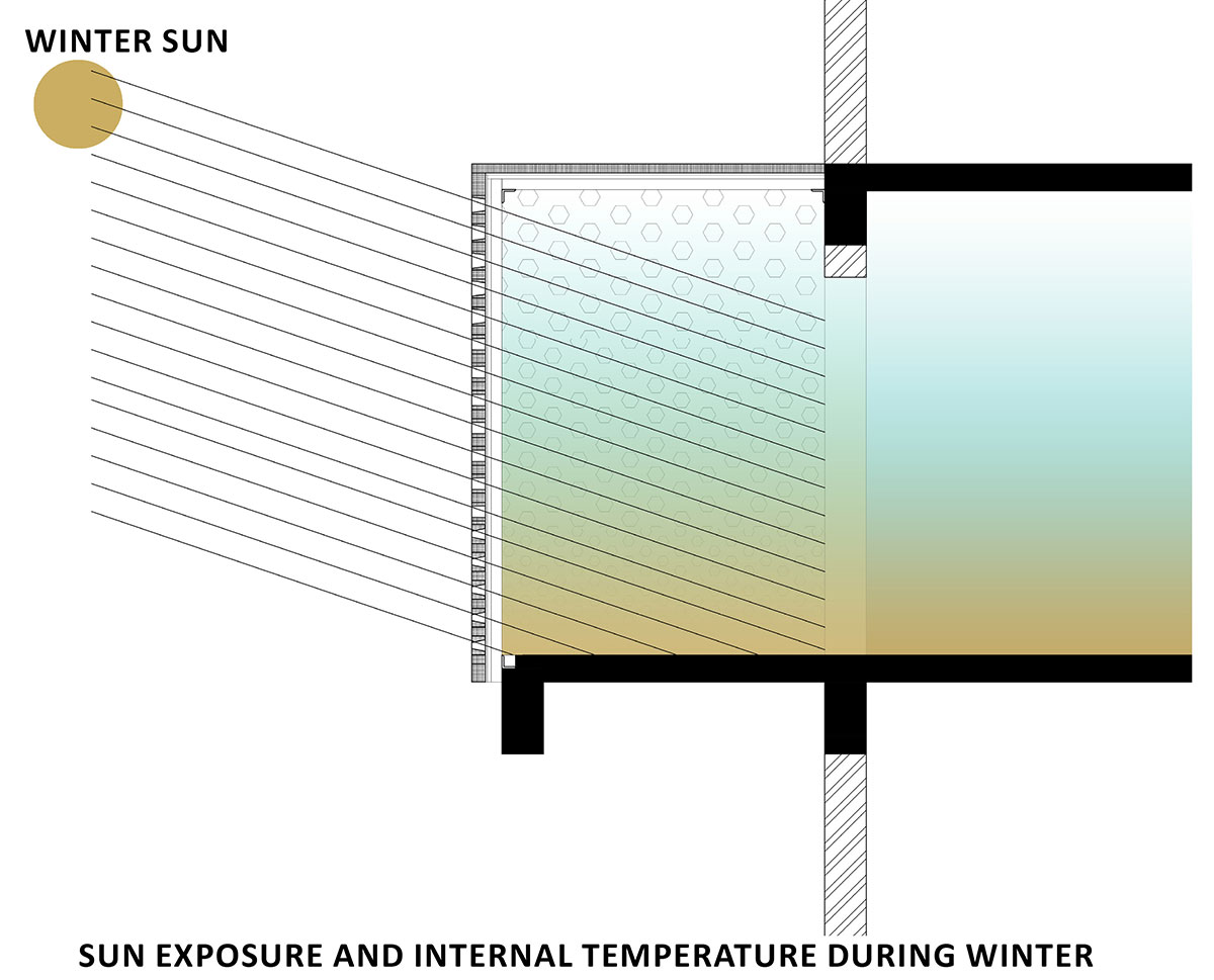
The Fenestration Layer: The fenestration is sandwiched between two vertical steel beams, with its inner placement shielding it from direct sunlight. Three levels of fenestration comprise the vertical division of the space: glass panels that let in light, vertical louvres that control the ventilation and airflow, and user-controlled hinged windows. When facing direct sunlight, the vertical louvres open in the opposite direction.
SectionExploded Axonometry and Wall Section
The Structural Layer: The system of steel tubular members that supports the roof is hinged or welded together using steel plates, depending on where the joinery is located. The steel system is supported by the ground floor’s RCC column grid. The hinged connections reduce bending moment to zero by acting as a barrier to plane movement.
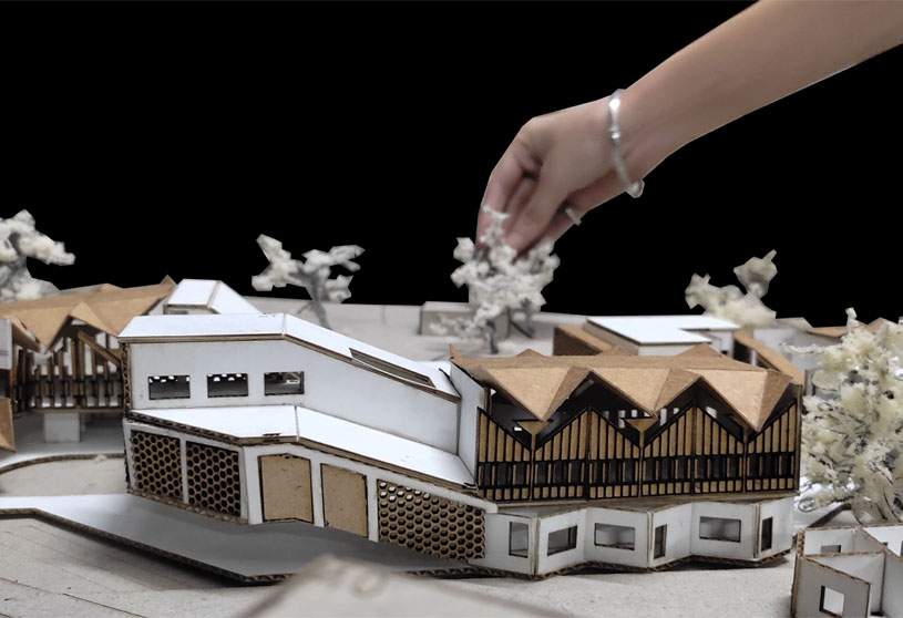
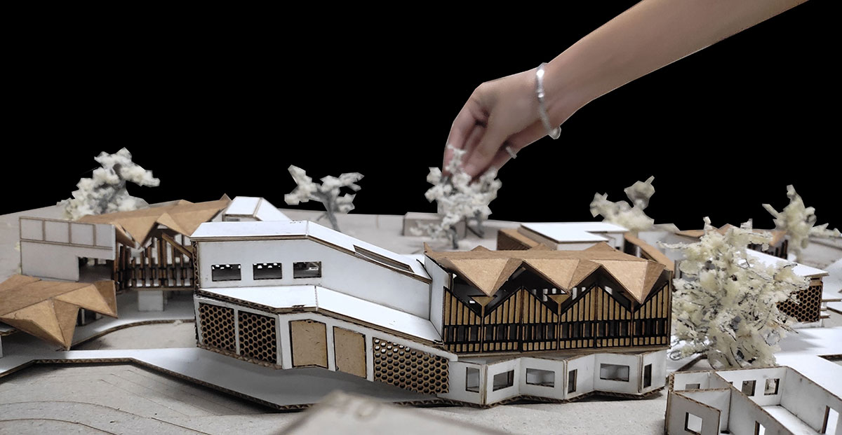
Congregation Space for Users from All Age GroupsPhysical Model
Conclusion: The project serves as a model for how the Arnala Island coastal community can start to adapt and grow into systems that are resistant to calamities. The intervention creates collective infrastructure bodies for occupations, celebrations, and community gatherings by incorporating changes into the existing networks.
[This Academic Project has been published with text submitted by the student]
Site Context
Design Process
Final Outcome
To submit your academic project for publication at ArchiDiaries, please visit the following link >> Submit