Date: 20.06.2020
Software used: Rhino 6, Grasshopper
Task 1
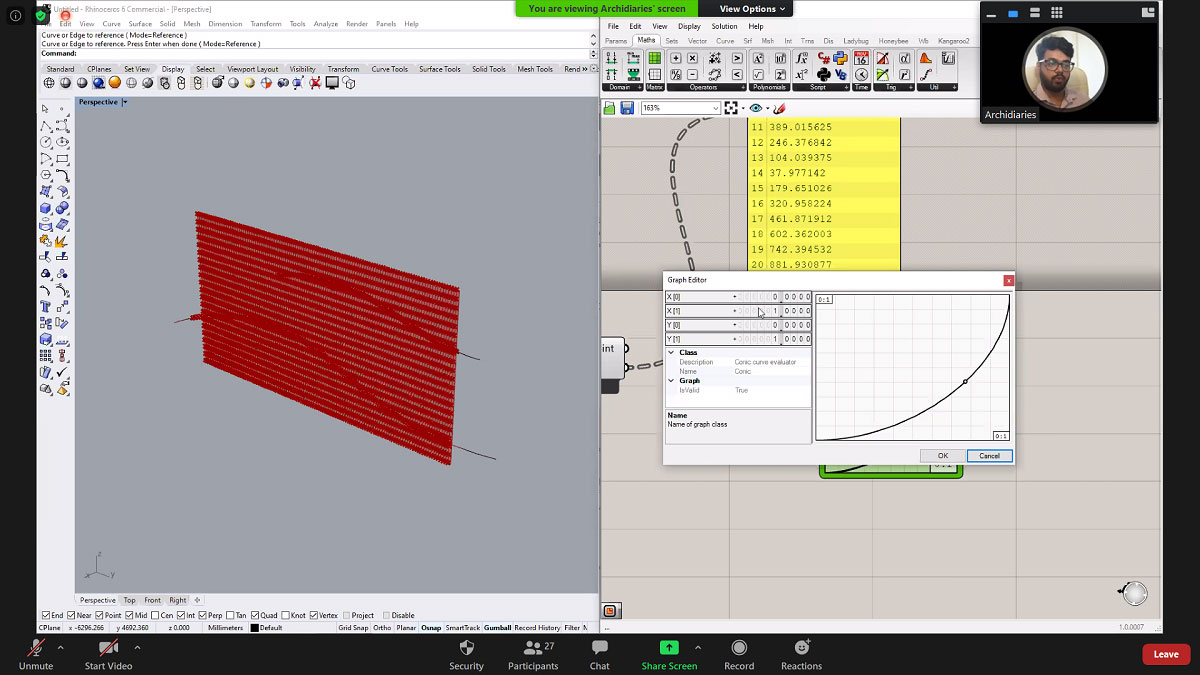
The exercise was to create a wave kind of panel from curves and a geometry using a pull point and Rich graph mapper.
Tools Used: Curve, Rectangle, Contour, Divide Curve, Pull Point, Rich Graph mapper, Bounds, Construct Domain, Move, Nurbs Curve, Loft, Extrude.
Polycurves created in rhino and a rectangle in grasshopper.
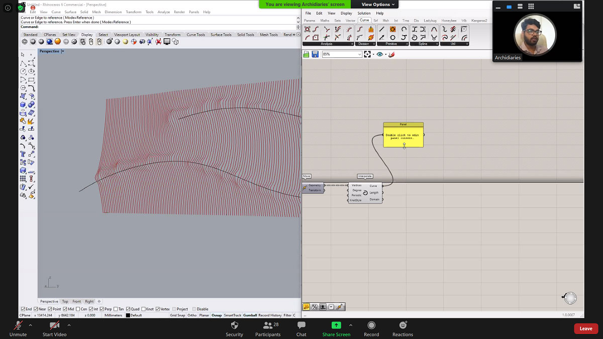
Forming contours from the rectangular geometry such that it molds according to the curve using pull points and rich graph mapper.
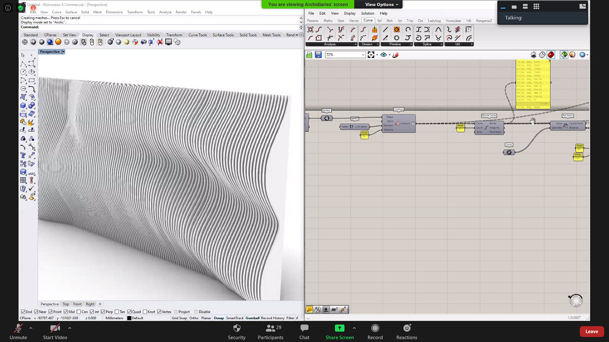
Final outcome after lofting the base curves and the curves generated from pull points. Thereafter, extruding the lofted surface.
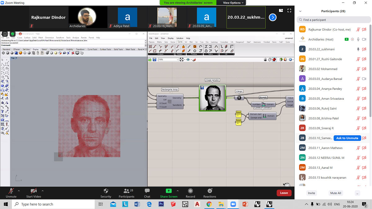
Task 2
Tools Used: Rectangle, Rectangular array, Construct Point, Image Sampler, Integer, Remap numbers, Bounds, Construct Domain, Circle, Move.
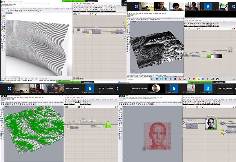
The exercise was to create a complex form using an image sampler. In this case, a portrait of a man was selected. Using an image sampler and remapping the values of the circle, the image was recreated with circular geometry.
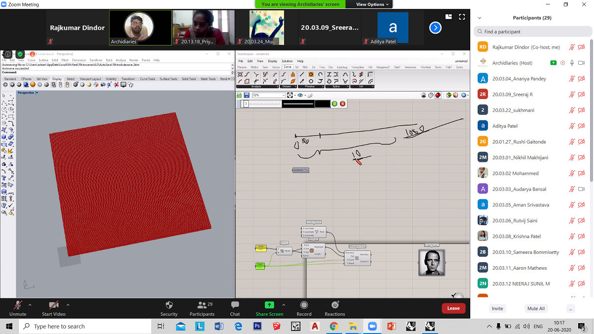
Rectangular array of points.
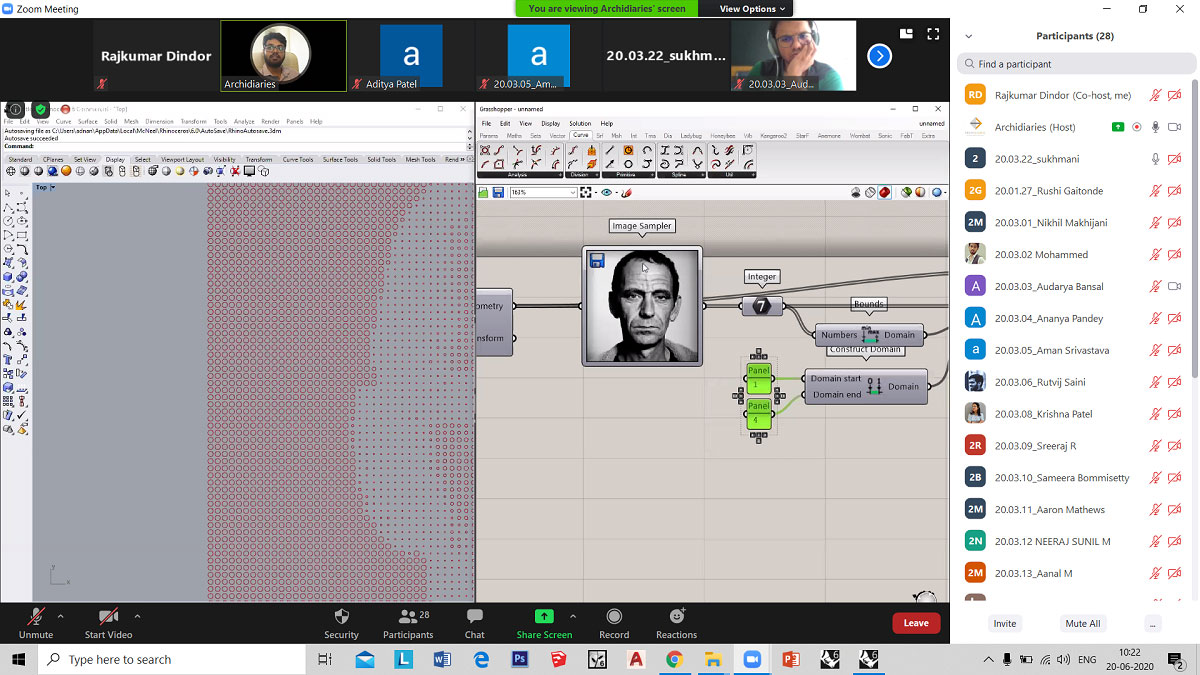
Circular geometry at array points are remapped to create the image in the portrait.
Final outcome.
Task 3
Tools Used: Rectangle, Rectangular array, Image sampler, Bounds, Construct domains, Remap numbers, Move, Delaunay Mesh, Isotrim, Surface from points, Area, Flow, Evaluate surface, MD Slider,Angle, Deconstruct domain, Gradient, Custom Preview, Graft Tree, Boolean Toggle, Advanced Bake.
This exercise was to create contours, water flow, identify steep and flat areas of a selected region. For this an image of a terrain region was selected. Using an image sampler and remapping the values of points, the points were moved in the z-axis according to high and low points of the terrain. Using Delaunay Mesh a surface was created from these points resulting into terrain. Further, using flow component was used to see flow of water in the region. Steepness and flatness on the generated mesh was done using evaluate surface and gradient. Lastly, contouring into poly curves of the mesh was done.
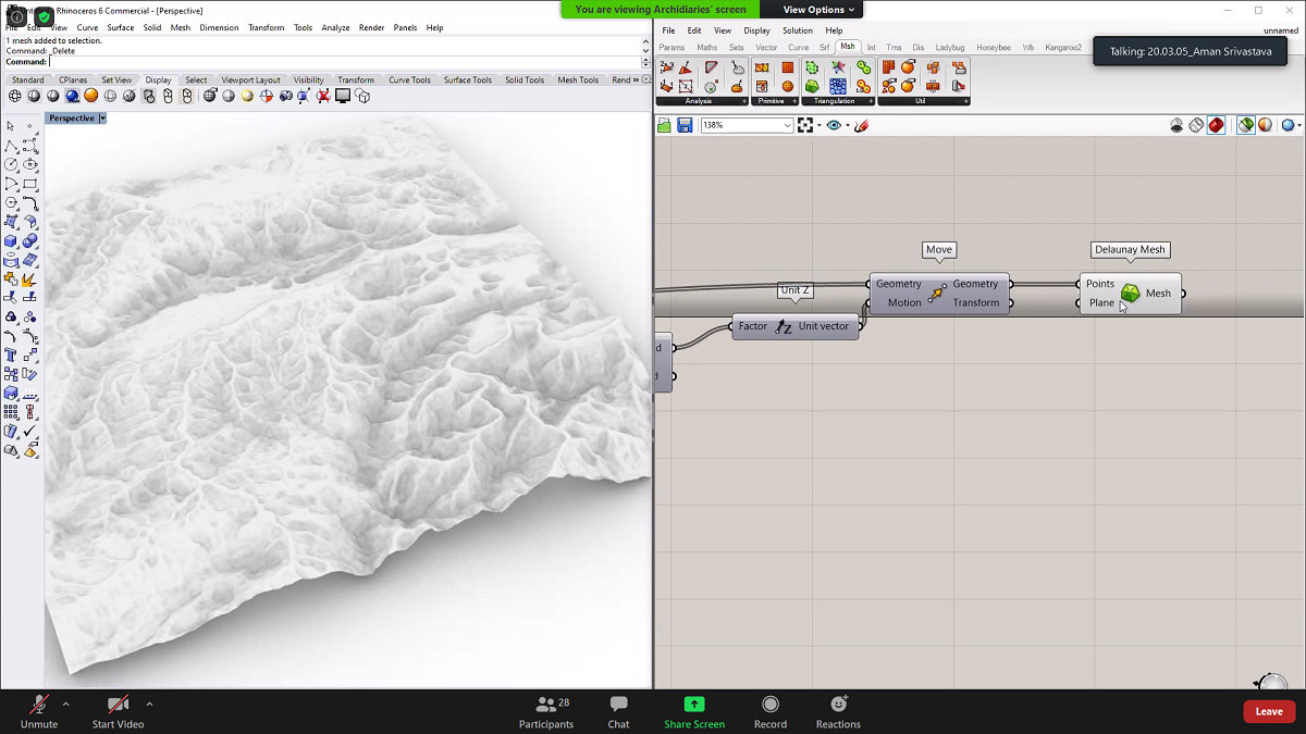
Mesh surface created using image sampler and Delaunay Mesh.
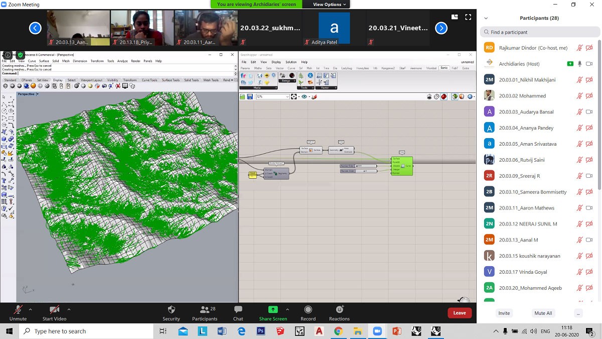
Direction of flow of water on terrain using flow.
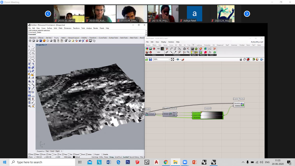
Gradient showing black as the steepest while white as flat surface in the selected terrain region.
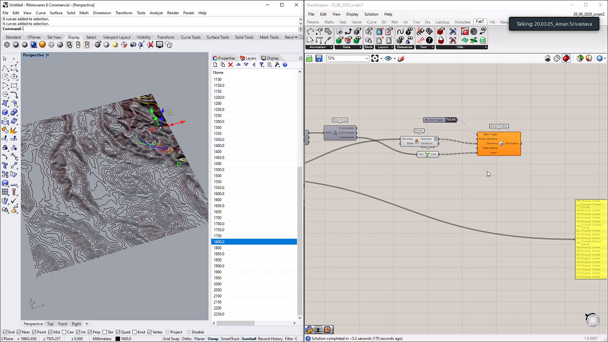
Contours at a difference of 0.5m are baked in rhino6 with each poly curve in separate layers.
Images